Advertising

Home Earth Continents Europe Political Map of the Baltic Sea

Maps Index

Political Map of the Baltic Sea


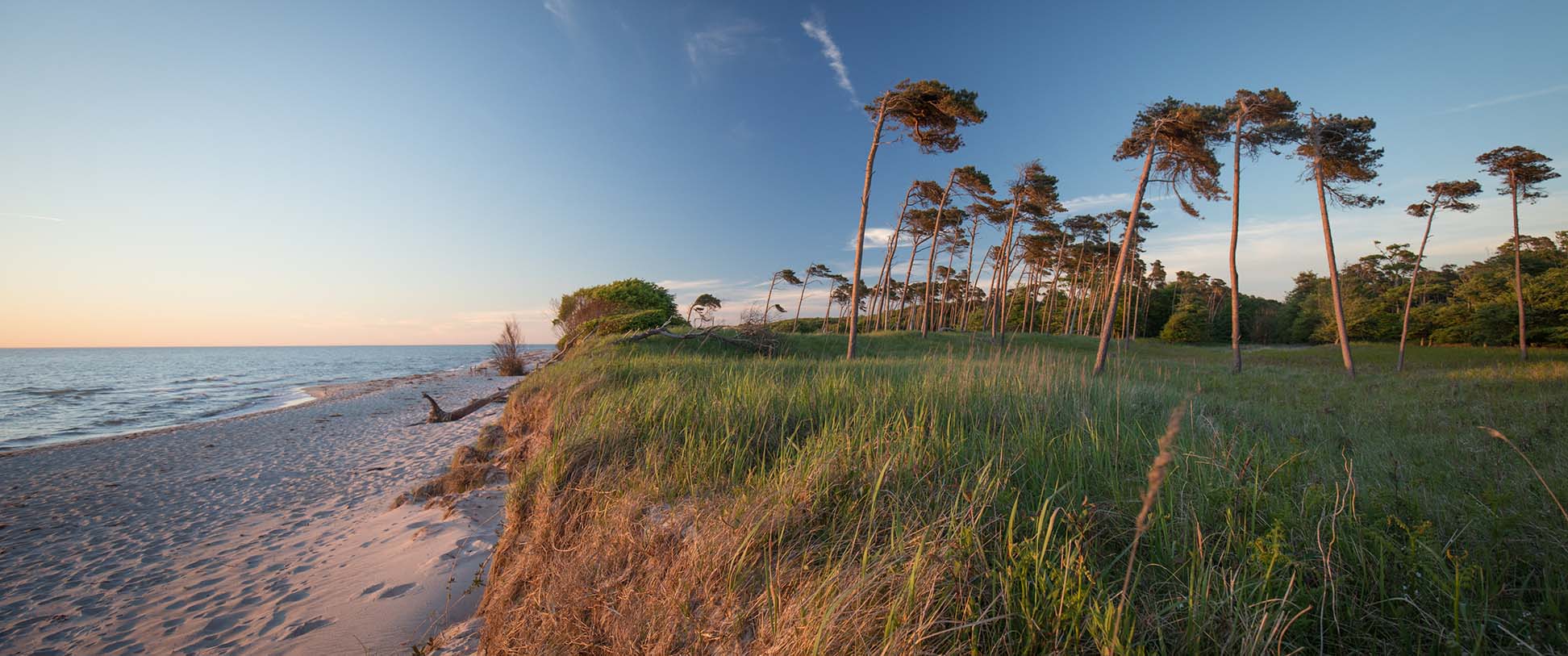
Beach at Haffkrug, Baltic Sea in Germany
Southern shore of the Baltic Sea between Ahrenshoop and Prerow on the Fischland-Darß-Zingst peninsula at sunset.
Image: Pfeifermarkus79

Political map of the Baltic Sea and surrounding areas


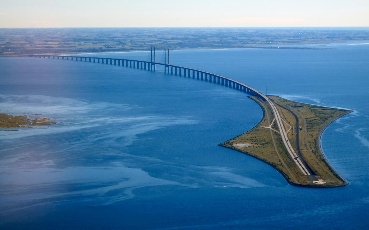
The Øresund Bridge, a rail and highway bridge over the Øresund Channel.
The Øresund Bridge, a rail and highway bridge over the Øresund, connects Denmark's capital Copenhagen with the Swedish mainland near Malmö.
Image: Nick-D

Ten thousand years ago, the waters we now know as the Baltic Sea were actually a vast inland sea, with only a few connections to the Atlantic Ocean through two or three rivers.

Nobody knows what the sea was called then, but scholars of today named it the Ancylus Lake. The lake's waters were the remains of several stages of the retreat of the melting Scandinavian ice sheet following the last glacial period we all know as the Ice Age.

Some thousand years later, the sea became an arm of the Atlantic Ocean and a popular tourist destination. Today, the Baltic sea is connected to the North Sea (a branch of the Atlantic Ocean itself) via the Øresund Channel and the Kattegat and Skagerrak Straits, enabling Vikings of past times just as cruise ships of today to roam the seas for business. In the 13th to the 15th century, the region was one of the main playgrounds and the commercial core of the Hanseatic League (Hanse), a confederation of merchants and city unions that became an economic and political power in Northern Europe.


Names
The Baltic Sea is known by a variety of names; the Germans call it Ostsee (East Sea), the Swedish Östersjön, in Danish it's Østersøen, in Russia, it is known as Baltiyskoye More, in Finland as Itämeri, for the Polish people it is Morze Bałtyckie, in Lithuania, they call it Baltijos jūra and in Estonia, the 'East Sea' is known as Läänemeri (West Sea).


Map of the Baltic Sea

Map of the Baltic Sea with surrounding countries
Political Map of the Baltic Sea

The map shows the Baltic Sea and surrounding countries with international borders, national capitals, chief ports, and major cities.

You are free to use the above map for educational and similar purposes; if you publish it online or in print, you need to credit Nations Online Project as the source.


More about the Baltic Sea


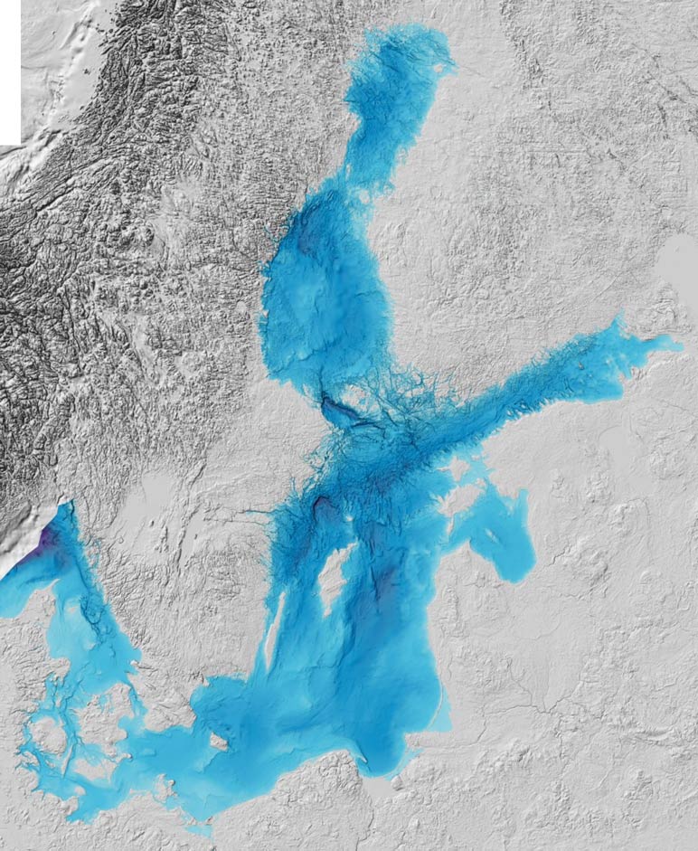
Bathymetry map of the Baltic Sea
Bathymetry of the Baltic Sea map shows the ocean is in large parts quite shallow (light blue).
Image: Baltic Sea Bathymetry Database

Countries
The Baltic Sea (including the Gulf of Bothnia and the Gulf of Finland) covers an area of 377,000 km2 (146,000 sq mi), making it somewhat larger than Germany or slightly smaller than the US state of Montana. Approximately 85 million people live in the larger Baltic Sea region and use the sea for various purposes [1].
There are nine countries with a shoreline at the Baltic Sea: Denmark, Germany, Poland, Russia (at the Gulf of Finland, and the Russian exclave of Kaliningrad Oblast), Lithuania, Latvia, Estonia, Finland, and Sweden.


Arms, Bays, Gulfs, and Spits
The Gulf of Bothnia between Finland's west coast and Sweden's east coast is the northernmost arm of the Baltic Sea, the shallow Gulf of Finland between Finland and Estonia is the easternmost. The Gulf of Riga is a bay between Latvia and Estonia. The Gulf of Gdańsk, also known as Gdańsk Bay, includes the Bay of Puck and the brackish water Vistula Lagoon, which is separated from the Gdańsk Bay by the Vistula Spit, a peninsular sand stretch. A similar spit lies to the northeast; it is the 98 km long Curonian Spit, a sand-dune spit between Kaliningrad Oblast and Lithuania that separates the Curonian Lagoon from the Baltic Sea.


Rivers (major tributaries)
There are about sixty rivers draining into the Baltic Sea. The rivers and rainwater are the reasons that the water of the relatively shallow sea is brackish, a mixture of fresh water and saline seawater. The Baltic Sea is the largest expanse of brackish water in the world.


The largest rivers are the Neva, the navigable Russian river that connects Lake Ladoga with the Neva Bay, the easternmost part of the Gulf of Finland. The Vistula, Poland's largest river, empties into Gdańsk Bay. The Oder river, which in parts forms the border between Poland and Germany, flows into the Szczecin Lagoon (Oder Lagoon). The 1,020 km long Daugava (Western Dvina) opens out into the Gulf of Riga. The Nemunas (Memel) empties into the Curonian Lagoon and the Kemijoki, Finland's longest river, spills into the Gulf of Bothnia at Kemi. The Narva, Estonia's largest river, connects Lake Peipus with the Gulf of Finland. The mouth of the Swedish Lule River (Luleälven) is at Luleå, the port city at the Gulf of Bothnia. The Torne river forms for some length the border between Sweden and Finland; its mouth is at the northern end of the Gulf of Bothnia.


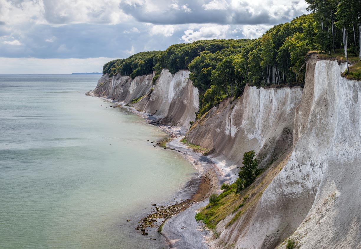
The famous chalk cliffs on the island of Rügen in Mecklenburg-Western Pomerania, Germany.
The famous chalk cliffs on the Baltic Sea island of Rügen in Mecklenburg-Western Pomerania, Germany.
Image: Moahim

Islands

Åland is an autonomous territory under Finnish sovereignty with a Swedish-speaking population. The archipelago with more than 6,000 islands and islets at the entry of the Gulf of Bothnia in the Archipelago Sea (Finland). Other larger islands are Hailuoto, west of the city of Oulu, and the Kvarken Archipelago, with the islands of Replot and Björkö near the city of Vaasa. Nearby is the Swedish island group of Holmöarna. Sweden's largest islands are Gotland and Öland.
Saaremaa and Hiiumaa are Estonia's largest islands.

Half of Denmark consists of islands, the largest being Zealand where Denmark's capital Copenhagen is located. Other Danish islands in the Baltic Sea are Ærø, Falster, Funen, Langeland, Lolland, and Møn. Bornholm, the trapezoidal Danish island south of Sweden, is covered in its center with one of the most extensive forests in Denmark (Almindingen).

The Polish Wolin island between the Bay of Pomerania and the Oder Lagoon is home to the Wolin National Park. Wolin is separated from the German/Polish island of Usedom by the Strait of Świna.
Rügen and Fehmarn are Germany's largest islands in the Baltic Sea.
Kotlin, the Russian island located near the head of the Gulf of Finland, lies about 30 km west of St Petersburg.
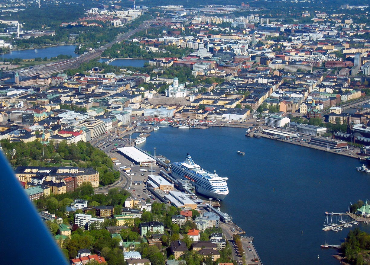

Aeriel view of the South Harbour of Helsinki, the capital of Finland.
Image: Henri Bergius

Ports
There are more than 200 sizable harbors on the Baltic Sea. Virtually all cities along the coast have some kind of port.
Several national capitals are also the largest ports, such as Helsinki, Tallinn, Stockholm, Copenhagen, and Riga.
The largest passenger ports are the Port of Helsinki, the Port of Tallinn, the Ports of Stockholm and the Port of Helsingborg.

Other important Swedish port cities are the cities of Ystad, Malmö, Gothenburg, Trelleborg, Halmstad, Gävle, Sundsvall, Luleå, Norrköping, and Visby. Major Finnish ports are Turku, Kotka, Pori, and Rauma. Largest German Baltic Sea ports are Rostock, Lübeck-Travemünde and Kiel.
Poland's port cities are Gdańsk, Szczecin (Stettin), and Gdynia. There are three major Russian ports, one at Kaliningrad (Kaliningrad Oblast), the other at Saint Petersburg, the largest Russian cargo port in the Baltics is Ust-Luga.

There are several ports in the Baltic countries; Latvia has two major port cities besides Riga, Ventspils and Liepāja. Lithuania's main port is Klaipėda, and Estonia's chief ports are Tallinn and Pärnu.

 
Major ports and port cities of the Baltic Sea

  • Estonia: Pärnu, Paldiski, Sillamäe, Tallinn
  • Finland: Espoo, Helsinki, Kotka, Oulu, Pori, Rauma, Turku, Vaasa
  • Germany: Flensburg, Kiel, Lübeck, Rostock, Sassnitz, Wismar
  • Latvia: Liepāja, Riga, Ventspils
  • Lithuania: Klaipėda
  • Poland: Gdansk, Gdynia (both Gdańsk Bay), Świnoujście/Szczecin (Szczecin Lagoon)
  • Russia: Kaliningrad (Kaliningrad Oblast), Primorsk, St. Petersburg, Ust-Luga, Vysotsk
  • Sweden: Gävle, Gothenburg, Halmstad, Helsingborg, Luleå, Malmö, Norrköping, Nynäshamn, Stockholm, Sundsvall, Trelleborg, Umeå, Ystad


Advertisements:


Advertisements:


Maps of Countries in Northern Europe
Denmark Map, Estonia Map, Faroe Islands Map, Finland Map, Greenland Map, Iceland Map, Ireland Map, Latvia Map, Lithuania Map, Sweden Map, United Kingdom Map

Countries bordering the Baltic Sea
Denmark Country Profile, Estonia Country Profile, Finland Country Profile, Germany Country Profile, Latvia Country Profile, Lithuania Country Profile, Poland Country Profile, Russia Country Profile, Sweden Country Profile

Major Cities in Northern Europe
Belfast | Cardiff | Copenhagen | Dublin | Edinburgh | Glasgow | Helsinki | Liverpool | London | Moscow | Nuuk | Oslo | Reykjavik | Riga | Saint Petersburg | Stockholm | Tallinn | Vilnius