Nations Online
All Countries in the World
|
One Planet Nations Online All Countries in the World | |
Home  |
___ Famous Landmarks - Satellite View of the Pre-Hispanic City of Chichen-Itza - Mexico |
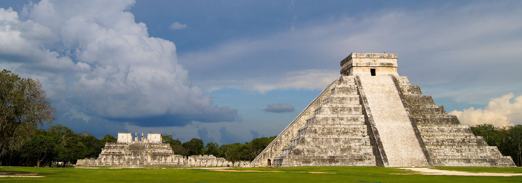
 Chichén Itzá complex with the famous step-pyramid of Kukulkan, known today as el Castillo (the castle) on the right, and the Temple of the Warriors (templo de los guerreros (left)). Image: Viatka |
About Chichen ItzaSatellite view is showing the archaeological site of Chichen Itza, built by the Mayan and later Toltec people, a 'lost' civilization still surrounded by much speculation even so archaeological research started over 100 years ago. Chichén was once one of the largest Mayan cities, with a relatively densely clustered architecture covering an area of more than 5 km² (2 sq mi). The city was inhabited for at least 800 years. Archaeological data now indicates that Chichen Itza was first settled in the mid 5th century and declined as a regional center by 1250. The town that grew up around the sector known today as Chichen Viejo with its important monuments was constructed between the 6th and the 10th centuries. The second settlement of Chichen-Itza, and the most important for historians, corresponded to the migration of Toltec warriors during the 10th century.The city was built upon broken terrain, which was artificially levelled in order to build the major architectural groups, with the greatest effort being expended in the levelling of the areas for the Castillo pyramid, and the Las Monjas, Osario and Main Southwest groups. The buildings of Chichen Itza are grouped in a series of architectonic sets, and each set was at one time separated from the other by a series of low walls. The three best known of these complexes are the Great North Platform, which includes the monuments of El Castillo, the Temple of Warriors and the Great Ball Court; The Osario Group, which includes the pyramid of the same name as well as the Temple of Xtoloc; and the Central Group, which includes the Caracol, Las Monjas, and Akab Dzib. The pyramid of Chichen Itza is a symbol of knowledge and place of worship of the Mayan culture. The pre-Columbian city is located in the northern center of the Yucatán Peninsula of present-day |
||||||
|
φ Latitude, λ Longitude (of Map center; move the map to see coordinates): , |
||||||
| Sorry! Google's pricing policy has made it impossible for us to continue showing Google Maps. We apologize for any inconvenience. Google Map: Satellite View of Chichen Itza, one of the greatest Mayan centers on the Yucatán peninsula. Coordinates: 20°40′59″N 88°34′7″W (Make sure 3D Buildings is checked in the Layers panel in Google Earth, eventually uncheck the Terrain layer.) |
Bookmark/share this page
|
|||||
| previous landmark: Luxor, Egypt |
next landmark: Hagia Sophia, Istanbul | |||||
| More about Mexico: Cities: Country: Continent: |
Current Weather Chichen Itza: External Links: Chichén Itza - Instituto Nacional de Antropología e Historia - INAH Chichen Itza articles by the National Institute of Anthropology and History. UNESCO World Heritage: Pre-Hispanic City of Chichen-Itza UNESCO World Heritage center entry of Chichen-Itza. Wikipedia: Chichen Itza |
Related Consumer Information:
|
||||
| Countries and Territories of The Americas | ||||||
Map Help [ show ]  |
||||||
One World - Nations Online .:. let's care for this planet Promote that every nation assumes responsibility for our world. Nations Online Project is made to improve cross-cultural understanding and global awareness. More signal - less NOISE |
| Site Map
| Information Sources | Disclaimer | Copyright © 1998-2023 :: nationsonline.org |