Nations Online
All Countries in the World
Nations Online All Countries in the World | |
Home  |
___ Satellite View and Map of the City of Bamako, Mali |
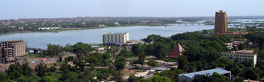 View of Bamako at the Niger river. The 20 stories BCEAO Tower is the tallest building in Mali. View of Bamako at the Niger river. The 20 stories BCEAO Tower is the tallest building in Mali.Image: Arensond |
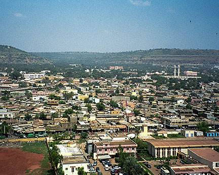
About Bamako Satellite view is showing Bamako, largest city and the national capital of Satellite view is showing Bamako, largest city and the national capital of Bamako has developed on the northern side of the river, but as one of the fastest growing cities in Africa, new urban quarters sprouted on the south shore of the river. Two bridges connect the historic part of the town with the suburbs. Until now Bamako can be very dusty, particularly in the dry season, and muddy during the rainy season, because there are only a few paved main roads, the rest of the city's streets are unpaved. Bamako has a population of about 1.8 million inhabitants. Spoken languages are French (official) and other vernacular languages, mainly of the Mande group. The city is located in the Sahel zone and has a tropical wet and dry climate with average temperature highs of over 30°C. The city is home to the Université de Bamako, also known as the University of Mali. The Bamako Grand Mosque and the National Museum of Mali, an archaeological and anthropological museum, are also located in Bamako. The map shows a city map of Bamako with expressways, main roads and streets, zoom out to find the location of Bamako-Sénou International Airport (IATA code: BKO) about 16 km (10 mi) south of the city. To find a location use the form below. To view just the map, click on the "Map" button. |
|
| To find a location type: street or place, city, optional: state, country. |
Local Time Mali:
Friday-April-19 03:10
Greenwich Mean Time (UTC/GMT 0 hours)
|
One World - Nations Online .:. let's care for this planet Promote that every nation assumes responsibility for our world. Nations Online Project is made to improve cross-cultural understanding and global awareness. More signal - less NOISE |
| Site Map
| Information Sources | Disclaimer | Copyright © 1998-2023 :: nationsonline.org |