One Planet
Nations Online

All Countries in the World
 

___ Satellite View and Map of the City of Charlotte Amalie, US Virgin Islands

 
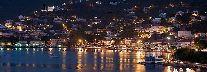
Charlotte Amalie, Saint Thomas Harbor at night
Saint Thomas Harbor in Charlotte Amalie at night.
Image: Calyponte
 

About Charlotte Amalie

Satellite view is showing Charlotte Amalie, the territorial capital and and largest city of the US Virgin Islands, a group of tropical islands and islets in the Caribbean.
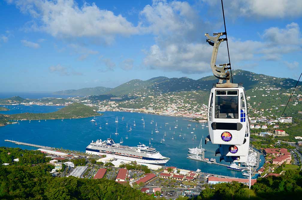
Charlotte Amalie on St. Thomas, US Virgin Islands
Charlotte Amalie, St. Thomas, US Virgin Islands, view from Lookout Point on Skyline Drive.
Photo by Matt Wade
 

The city was founded in 1666 as Taphus (meaning "beer house"). In 1691 the town was named after Charlotte Amalie of Hesse-Kassel, the wife of King Christian V of Denmark. Today Charlotte Amalie has a population of only about 19,000 citizens. Official language is English.

The town is located on the island of Saint Thomas, the gateway island of the U.S. Virgin Islands. Havensight, the deep-water harbor, is a major port of call (a premier stop) for cruise ships. It is one of the busiest cruise ports in the Caribbean with 2 million passengers per year. Since the end of the Second World War, tourism has been by far the most important economic sector in the Virgin Islands.


Charlotte Amalie Points of interest:

The city is known for its Danish colonial architecture and its mixture of American- and Afro-Caribbean culture, tourist attractions are Blackbeard's Castle (a tower and vantage point), Fort Christian (a 17th-century Danish-built fort), Coral World Ocean Park (marine park), the Legislature Building, the 99 steps stairway, the Emancipation Garden, the Market Square, the Seven Arches Museum, St. Thomas Synagogue (a historic synagogue) and the Weibel Museum (300 years of Jewish history), the Frederick Lutheran Church (historic church, it was the official church of the Danish West Indies).

The Map shows a city map of Charlotte Amalie with main roads and streets. Zoom out to see the location of the Virgin Islands in the Caribbean.

To find a location use the form below. To view just the map, click on the "Map" button. 
 
To find a location type: street or place, city, optional: state, country.

Local Time Charlotte Amalie:
Tuesday-April-16  12:01  
UTC/GMT -4 hours
φ Latitude, λ Longitude (of Map center; move the map to see coordinates):
,
 
Google Earth: Searchable map/satellite view of Charlotte Amalie,
US Virgin Islands.

 
City Coordinates: 18°21′N 64°57′W
 
Bookmark/share this page
Instagram

 
More about US Virgin Islands:

Searchable map/satellite view of the Virgin Islands
Political Map of Puerto Rico and Virgin Islands
US Virgin Islands Country Profile

More about the USA:
U.S. States:
US State Capitals
Profile of the 50 U.S. States
Maps of the 50 U.S. States
Flags of the 50 U.S. States
Area of the 50 U.S. States
Population of the 50 U.S. States

Country:
Map of the USA
Searchable map/satellite view of the United States.
Time zone map of the USA
Major US Airports
Most populated cities in the U.S.
USA Country Profile

Map of Central America and the Caribbean

 
Weather Conditions Charlotte Amalie


External Links:
U.S. Virgin Islands Department of Tourism

The Virgin Islands Daily News
Local news.

Wikipedia: Charlotte Amalie
Wikipedia entry Charlotte Amalie.
Related Consumer Information:


Other Cities and Islands in the Caribbean:
Basse-Terre (Guadeloupe), Basseterre (Saint Kitts and Nevis), Bridgetown (Barbados), Castries (Saint Lucia)
Fort-de-France (Martinique), Hamilton (Bermuda), Havana (Cuba), Kingston (Jamaica),
Kingstown (Saint Vincent and the Grenadines), Nassau (Bahamas), Oranjestad (Aruba), Port-au-Prince (Haiti),
Port-of-Spain (Trinidad and Tobago), Roseau (Dominica), Saint George's (Grenada),
Saint John's (Antigua and Barbuda), Saint Martin (Sint Maarten), San Juan (Puerto Rico),
Santo Domingo (Dominican Republic), The Valley (Anguilla), Willemstad (Curaçao)
 
Most Populous U.S. Cities:
1. New York City | 2. Los Angeles | 3. Chicago | 4. Houston | 5. Philadelphia
6. Phoenix | 7. San Antonio | 8. San Diego | 9. Dallas | 10. San Jose
11. Austin | 12. Jacksonville | 13. San Francisco | 14. Indianapolis | 15. Columbus

Other Major U.S. Cities:
Albany | Anchorage | Annapolis | Atlanta | Atlantic City | Augusta | Baltimore | Baton Rouge | Bismarck
Boise | Boston | Carson City | Charleston, WV | Charlotte | Cheyenne | Cincinnati | Cleveland | Columbia
Concord | Denver | Des Moines | Detroit | Dover, DE | El Paso | Fort Worth | Frankfort | Harrisburg | Hartford
Helena | Honolulu | Jackson | Jefferson City | Juneau | Kansas City | Lansing | Las Vegas | Lincoln
Little Rock | Long Beach | Madison | Memphis | Miami | Milwaukee | Minneapolis | Montgomery | Montpelier | Nashville
New Orleans | Norfolk | Oklahoma City | Olympia | Orlando | Pierre | Pittsburgh | Portland | Providence
Richmond, VA | Raleigh | Sacramento | St. Louis | St. Paul | Salem (OR) | Salt Lake City | Santa Fe | Seattle | Springfield
Tallahassee | Tampa | Topeka | Trenton | Tucson | Washington D.C.
 

Map Help [ show ]
 
up