Nations Online
All Countries in the World
|
One Planet Nations Online All Countries in the World | |
Home  |
___ Satellite View and Map of the City of Kinshasa, Democratic Republic of the Congo (formerly Zaire) |
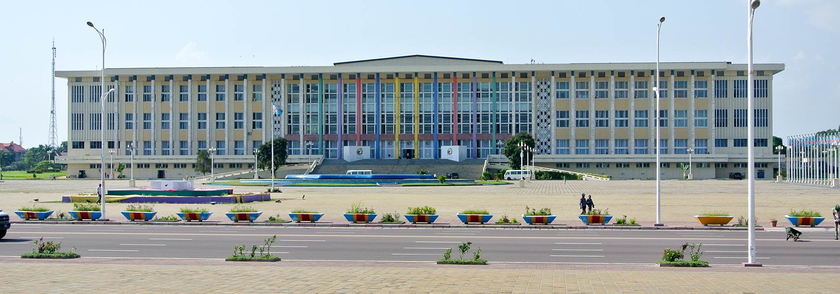
 The People's Palace is the seat of the National Assembly and Senate in Kinshasa. Image: Antoine Moens de Hase |
|
About Kinshasa Satellite view is showing Kinshasa, largest city and the national capital of Satellite view is showing Kinshasa, largest city and the national capital of The city is the political, economic and cultural center of the country. Kinshasa is the seat of the Congolese government, the parliament, all state authorities and numerous diplomatic missions. It is the most important traffic hub in the country with the international airport N'djili Airport and has numerous universities, colleges and museums. The city has the administrative status of a province. Kinshasa has a population of about 11 million inhabitants, making it one of Africa's largest cities. Spoken languages are French (official) and Lingala. The map shows a city map of Kinshasa with expressways, main roads and streets, zoom out to find the location of N'djili Airport (IATA code: FIH) about 16 km (10 mi) east of the city. To find a location use the form below. To view just the map, click on the "Map" button. |
|
| To find a location type: street or place, city, optional: state, country. |
Local Time Democratic Republic of the Congo:
Thursday-April-25 06:09
West Africa Time (WAT) :: UTC/GMT +1 hours |
|
φ Latitude, λ Longitude (of Map center; move the map to see coordinates): , |
||||||
| Google Earth: Map/satellite view of Kinshasa, capital of the Democratic Republic of the Congo, on the other side of the river lies Brazzaville, capital of the Republic of the Congo. City Coordinates: 4°19′30″S 15°19′20″E |
Bookmark/share this page
|
|||||
| More about Democratic Republic of the Congo: Country: Continent: External Links: Ville de Kinshasa Official website of the city of Kinshasa. (in French) Wikipedia: Kinshasa |
Kinshasa Weather Conditions |
Related Consumer Information:
|
||||
Other Capital cities in Central Africa Bangui, Brazzaville, Libreville, Luanda, Malabo, N'Djamena, São Tomé, Yaounde Countries and Territories of Africa |
||||||
Map Help [ show ]  |
||||||
One World - Nations Online .:. let's care for this planet Promote that every nation assumes responsibility for our world. Nations Online Project is made to improve cross-cultural understanding and global awareness. More signal - less NOISE |
| Site Map
| Information Sources | Disclaimer | Copyright © 1998-2023 :: nationsonline.org |