Nations Online
All Countries in the World
Nations Online All Countries in the World | |
Home  |
___ Satellite View of Pago Pago, American Samoa |
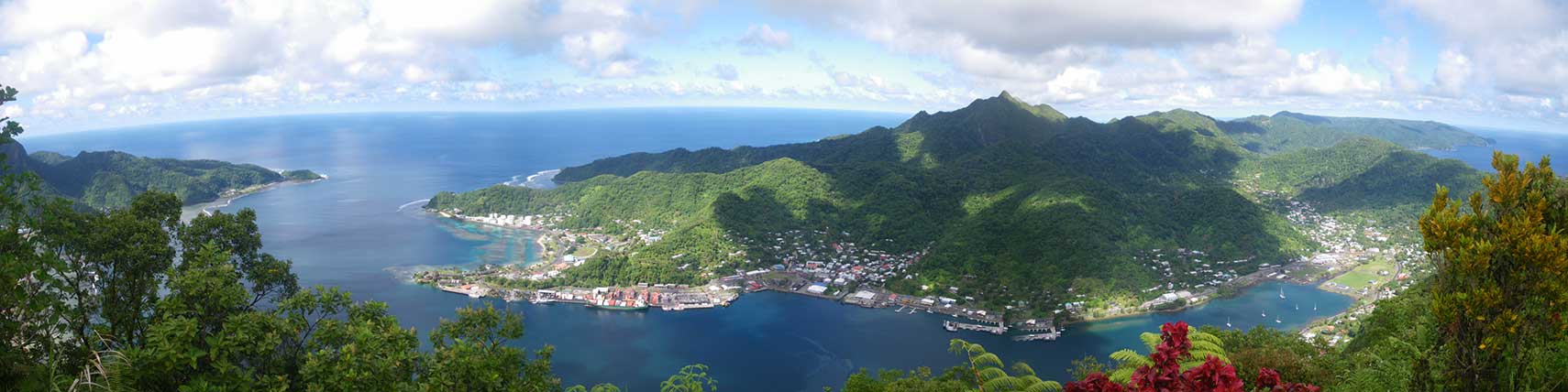 Pago Pago seen from Mount 'Alava in the National Park of American Samoa. Image: Naomi |
About Pago Pago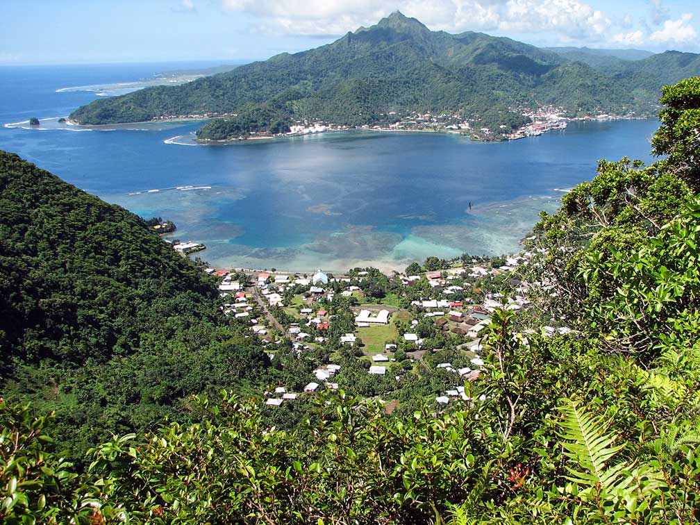 Afono village, Pago Pago Harbor, Tutuila Island, with Matafao in background, the tallest peak on Tutuila at 2,142 feet (653 m). Image: nps.gov Satellite View is showing Pago Pago, territorial capital of the U.S. territory of 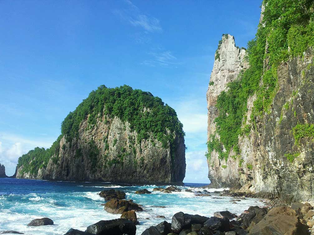 Vaiava Strait National Natural Landmark, Tutuila. A classic illustration of steep cliffs and erosion-resistant outliers formed by wave action on a volcanic land mass. Image: Richie Nomura Fagatogo Marketplace (shopping Polynesian style) |
|
| To find a location type: street or place, city, optional: state, country. |
Local Time American Samoa:
Tuesday-April-16 10:39
American Samoa Time: UTC -11 hours |
|
, |
||||||
| Sorry! Google's pricing policy has made it impossible for us to continue showing Google Maps. We apologize for any inconvenience. Google Map: Satellite View of Pago Pago, capital of the U.S. territory of American Samoa. City Coordinates: 14°16′46″S 170°42′02″W |
Bookmark/share this page |
|||||
| More about American Samoa: Country: Continent: |
Weather Conditions Pago Pago
External links: American Samoa American Samoa Visitors Bureau: Samoa News Local News. Wikipedia: Pago Pago Wikipedia entry Pago Pago. |
Related Consumer Information:
|
||||
Other Polynesian Island Nations and Territories: Cook Islands, French Polynesia (Tahiti), Niue, Pitcairn, Samoa, Tonga, Tuvalu Countries and territories of Australia/Oceania |
||||||
Map Help [ show ] |
||||||
One World - Nations Online .:. let's care for this planet Promote that every nation assumes responsibility for our world. Nations Online Project is made to improve cross-cultural understanding and global awareness. More signal - less NOISE |
| Site Map
| Information Sources | Disclaimer | Copyright © 1998-2023 :: nationsonline.org |

