Nations Online
All Countries in the World
Nations Online All Countries in the World | |
Home  |
___ Satellite View and Map of the City of Saint George's, Grenada |
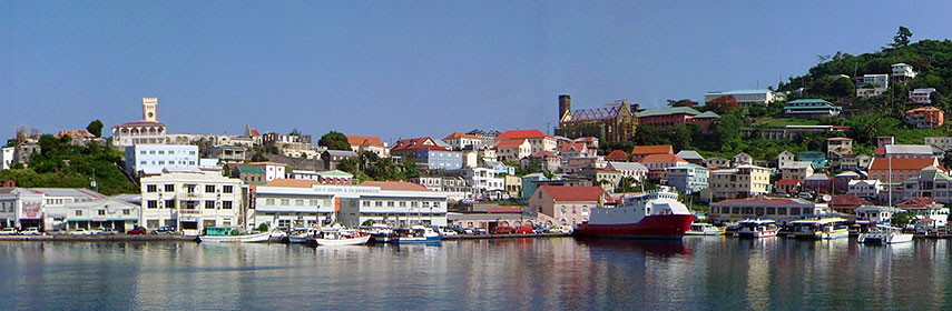 View of St. George's Bay, St. George, Grenada. Image: Dpursoo |
About St. George'sSatellite view is showing Saint George's, the capital ofThe city is located in southwest of the island at St. George's Bay surrounded by a hilly remains of an old volcano crater. The municipality has a population of about 7,500 people, and 33,000 inhabitants live in its greater area. Official language is English and Patois. Grenada is famous for its spices, it is known as the "Isle of Spices", the island is the world's second largest producer of nutmegs, and a leading producer of several other spices as cocoa, cinnamon, mace, cloves, vanilla, and ginger. The island was severely bashed-up by Hurricane Ivan in 2004, the storm crippled much of the island's infrastructure and destroyed many of its nutmeg and cocoa plantations. Some points of interest: Grenada National Museum (a former prison), Fort George (dilapidated historical fort, built in 1705), Market Square, Grande Anse beach (shopping), St. Margaret's Falls (waterfalls), Mt. St Catherine (hiking), Grand Etang Nature Reserve (with a crater lake). The map shows the city map of Saint George's with some main roads, zoom out to find the location of Maurice Bishop International Airport (IATA code: GND) about 12.6 km (7.8 mi) by road (via Maurice Bishop Memorial Highway/ Grand Anse Valley Rd) south west of the city. To find a location use the form below. |
||
| To find a location type: street or place, city, optional: state, country. | Local Time Grenada:
Thursday-April-18 12:27
UTC/GMT -4 hours |
|
One World - Nations Online .:. let's care for this planet Promote that every nation assumes responsibility for our world. Nations Online Project is made to improve cross-cultural understanding and global awareness. More signal - less NOISE |
| Site Map
| Information Sources | Disclaimer | Copyright © 1998-2023 :: nationsonline.org |

