Nations Online
All Countries in the World
Nations Online All Countries in the World | |
Home  |
___ Satellite View and Map of Mongolia (Mongol Uls) |
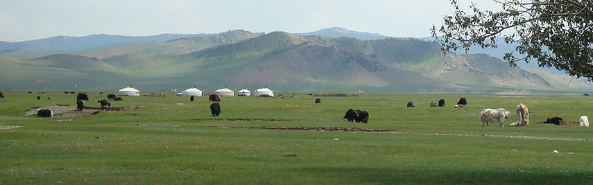 Pasture land with Gers (Mongolian yurts) near Tsetserleg, the capital of Arkhangai aimag (province), in central Mongolia. Image: Arabsalam |
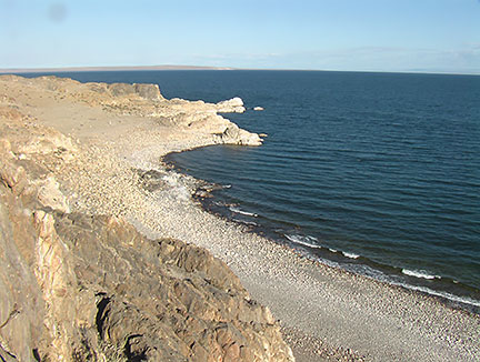
About Mongolia Map is showing Mongolia a large and sparsely populated, landlocked country in eastern Asia south of Russia and north of China. With an area of 1,564,100 km² Mongolia is twice the size of Turkey or slightly smaller than Alaska. Map is showing Mongolia a large and sparsely populated, landlocked country in eastern Asia south of Russia and north of China. With an area of 1,564,100 km² Mongolia is twice the size of Turkey or slightly smaller than Alaska.The area of what is now Mongolia has been ruled by various nomadic empires for centuries. In 1206, Genghis Khan founded the Mongol Empire, and his grandson Kublai Khan conquered China to establish the Yuan dynasty. During the collapse of the Manchu-founded Qing dynasty in 1911, Mongols established the Temporary Government of Khalkha on 30 November 1911. This was before the forced abdication of Puyi, the last Qing emperor and the establishment of the Republic of China. The "Country of Blue Sky" offers a great variety of landscapes, there is the Gobi Desert to the south east, an arid and semiarid region that is bounded by the grasslands and steppes of Mongolia and the Altai Mountains in the north. The Nairamdal Peak of the Altai Tavan Bogd (five saints mountain) massif mountain marks the corner between the three neighboring countries in far west, nearby located on the Mongolian-Chinese border, is the Khüiten Peak, the highest mountain in Mongolia with 4374 m. And there is the mountainous region in the center of the country with the Khangai Mountains. Between the Altai and the Khangai mountain ranges is Mongolia's Great Lakes Depression with six major fresh and saltwater lakes. Today Mongolia has a population of just over 3 million people (2016), capital city of Mongolia is Ulaanbaatar (pop.: 1 million). Official language is Mongolian. Countries with international borders to Mongolia are to the south the Chinese autonomous territory of Xinjiang, the Gansu province and Inner Mongolia, an autonomous region in northern China; in north (from west to east) by the republics of Altai, Tuva (Tyva), and Buryatia, and Zabaykalsky Krai, all subdivisions of the Russian Siberian Federal District. The map shows Mongolia with cities, towns, expressways, main roads and streets. Zoom in to see the administrative boundaries of Mongolia's provinces. To find a location use the form below. To view just the map, click on the "Map" button. |
|
| To find a location type: street or place, city, optional: state, country. |
Local Time Ulaanbaatar:
Friday-April-19 08:24
UTC/GMT +8 hours |
|
φ Latitude, λ Longitude (of Map center; move the map to see coordinates): , |
||||||
| Google Earth: Map/Satellite View of Mongolia (Mongol Uls). | Bookmark/share this page |
|||||
| More about Mongolia: Mongolia key statistical data. |
Weather Conditions Ulaanbaatar
|
Related Consumer Information:
|
||||
| More Searchable Maps of Countries in Eastern Asia China, x, Japan, North Korea, South Korea, Taiwan Countries and Territories of Asia |
||||||
Map Help [ show ] |
||||||
One World - Nations Online .:. let's care for this planet Promote that every nation assumes responsibility for our world. Nations Online Project is made to improve cross-cultural understanding and global awareness. More signal - less NOISE |
| Site Map
| Information Sources | Disclaimer | Copyright © 1998-2023 :: nationsonline.org |