Nations Online
All Countries in the World
Nations Online All Countries in the World | |
Home  |
___ Satellite View and Map of New Zealand (Aotearoa is the Maori name of the country) |
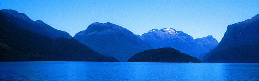 Lake Te Anau in the southwestern corner of the South Island is the second-largest lake in New Zealand. Image: James Shook |
About New Zealand Satellite view is showing the island nation in the South Pacific Ocean about 2,000 km (1,300 mi) east of Australia. With an area of 270,467 km², New Zealand is somewhat larger than the United Kingdom or about the size of the U.S. state of Colorado. Satellite view is showing the island nation in the South Pacific Ocean about 2,000 km (1,300 mi) east of Australia. With an area of 270,467 km², New Zealand is somewhat larger than the United Kingdom or about the size of the U.S. state of Colorado.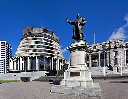 Seddon Statue at New Zealand's Parliament House (right) and the Beehive (rear left), the Executive Wing of New Zealand's Parliament Buildings in Wellington. Image: russellstreet New Zealand has a population of 4,675,000 (in 2016), national capital is Wellington, chief seaport, largest and most populous city in the country is Auckland, both cities are located on the North Island. Spoken languages are English (98%) and Māori (about 4%), both official. The Fiordland and Southern Lakes in the south-western corner of the South Island where the location for the mythical Middle Earth in the "Lord of the Rings" films. New Zealand came under British sovereignty in 1840. Full dominion status was granted in 1907, and independence within the Commonwealth of Nations came in 1931. The Map shows New Zealand with cities, towns, expressways, main roads and streets. To find a location use the form below. To view the map, click on the "Map" button. |
|
| To find a location type: street or place, city, optional: state, country. |
Local Time New Zealand:
Thursday-April-18 08:48
New Zealand Standard Time (NZST) UTC+12New Zealand Daylight Time (NZDT) UTC+13 from end of September until the first Sunday in April |
|
φ Latitude, λ Longitude (of Map center; move the map to see coordinates): , |
||||||
| Sorry! Google's pricing policy has made it impossible for us to continue showing Google Maps. We apologize for any inconvenience. Google Map: Searchable map/satellite view of the islands of New Zealand (Aotearoa). |
Bookmark/share this page |
|||||
| More about New Zealand: Cities: Country: Continent: |
Weather Conditions Wellington
|
Related Consumer Information:
|
||||
| Countries and Territories of Australia/Oceania Countries of the World: A - C | D - G | H - L | M - P | Q - T | U - Z Continents: Africa | The Americas | Asia | Europe |
||||||
Map Help [ show ] |
||||||
One World - Nations Online .:. let's care for this planet Promote that every nation assumes responsibility for our world. Nations Online Project is made to improve cross-cultural understanding and global awareness. More signal - less NOISE |
| Site Map
| Information Sources | Disclaimer | Copyright © 1998-2023 :: nationsonline.org |

