
|
|
___ Political Map of Guinea Bissau |
|
| Guinea Bissau is a country on the western coast of Africa, between Senegal and Guinea. The country is slightly bigger than Belgium, but slightly smaller than Switzerland. Guinea Bissau has a population of about 1,53 million people (2015). Capital city is Bissau. Spoken languages are, Portuguese (official), West African languages, and Kriol (Portuguese-based creole). Map is showing Guinea Bissau with surrounding countries, states borders, the national capital, provincial capitals, cities, main roads and major airports. |
 Bookmark/share this page |
 One World - Nations Online All Countries of the World |
|
|
||
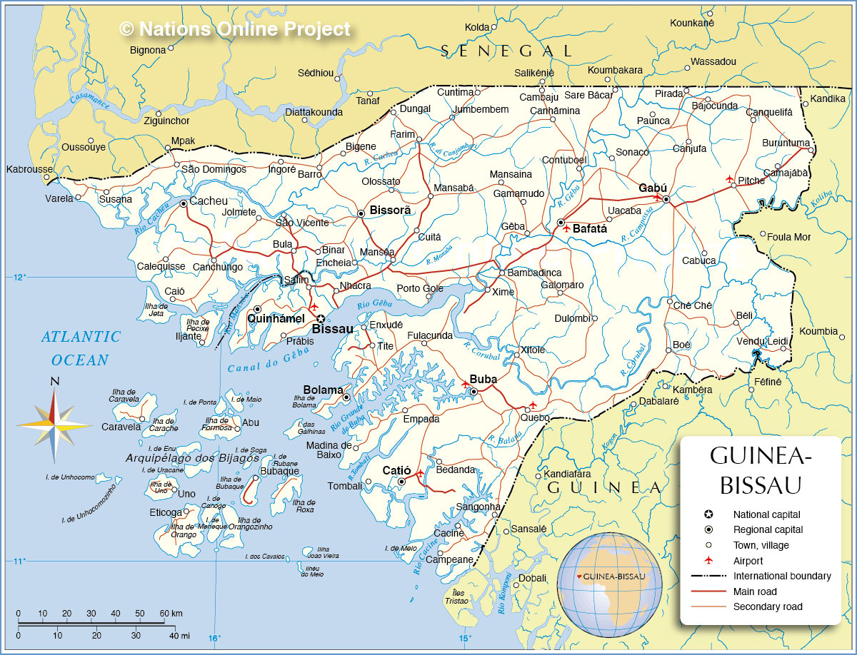 Political Map of Guinea Bissau |
| Cities in Guinea Bissau Map shows the location of following cities and towns in Guinea Bissau by regions: Bafatá Bafatá, Bambadinca, Cambaju, Canhâmina, Contuboel, Dulombi, Galomaro, Gamamudo, Gêba, Mansaina, Sare Bácar, Xime, Xitole Biombo Prábis, Quinhámel, Safim Bolama Abu, Bolama, Bubaque, Caravela, Eticoga, Uno Cacheu Barro, Bigene, Bula, Cacheu, Caió, Calequisse, Canchungo, Ingoré, Jolmete, São Domingos, São Vicente, Susana, Varela Gabú Bajocunda, Béli, Boé, Buruntuma, Cabuca, Camajábà, Canjufa, Canquelifá, Ché Ché, Gabú, Paunca, Pirada, Pitche, Sonaco, Uacaba, Vendu Leidi Oio Binar, Bissorã, Cuitá, Cuntima, Dungal, Encheia, Farim, Jumbembem, Mansabá, Mansôa, Nhacra, Olossato, Porto Gole Quinara Buba, Empada, Enxudé, Fulacunda, Madina de Baixo, Tite Tombali Bedanda, Cacine, Campeane, Catió, Quebo, Sangonha, Tombali |
More about Guinea-Bissau: Cities: Country: Continent: |
Current Weather Conditions Bissau:
|
Related Consumer Information: |
||||
Political Maps of other Countries in West Africa: Benin Map | Burkina Faso Map | Cape Verde Map | Côte d'Ivoire Map | Ghana Map | Guinea Map Liberia Map | Mali Map | Mauritania Map | Niger Map | Nigeria Map | Senegal Map | Sierra Leone Map | Togo Map |
|||||||
One World - Nations Online .:. let's care for this planet Every nation is responsible for the current state of our world. |
| Site Map
| Information Sources | Disclaimer: Privacy Policy, etc. Contact: [email protected] | Copyright © 1998-2021 :: nationsonline.org |
