Advertising

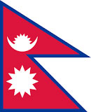
Nepal Flag detail
Home Earth Continents Asia Nepal Country Profile Map of Nepal

Maps Index


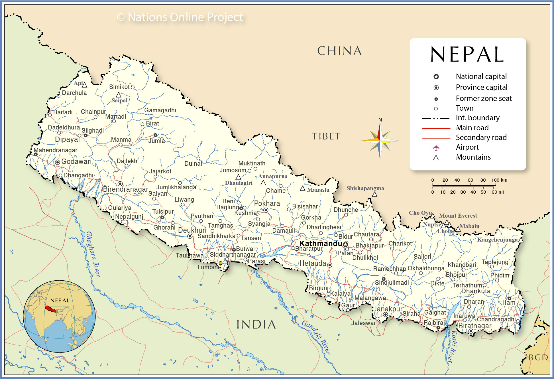
Political Map of Nepal


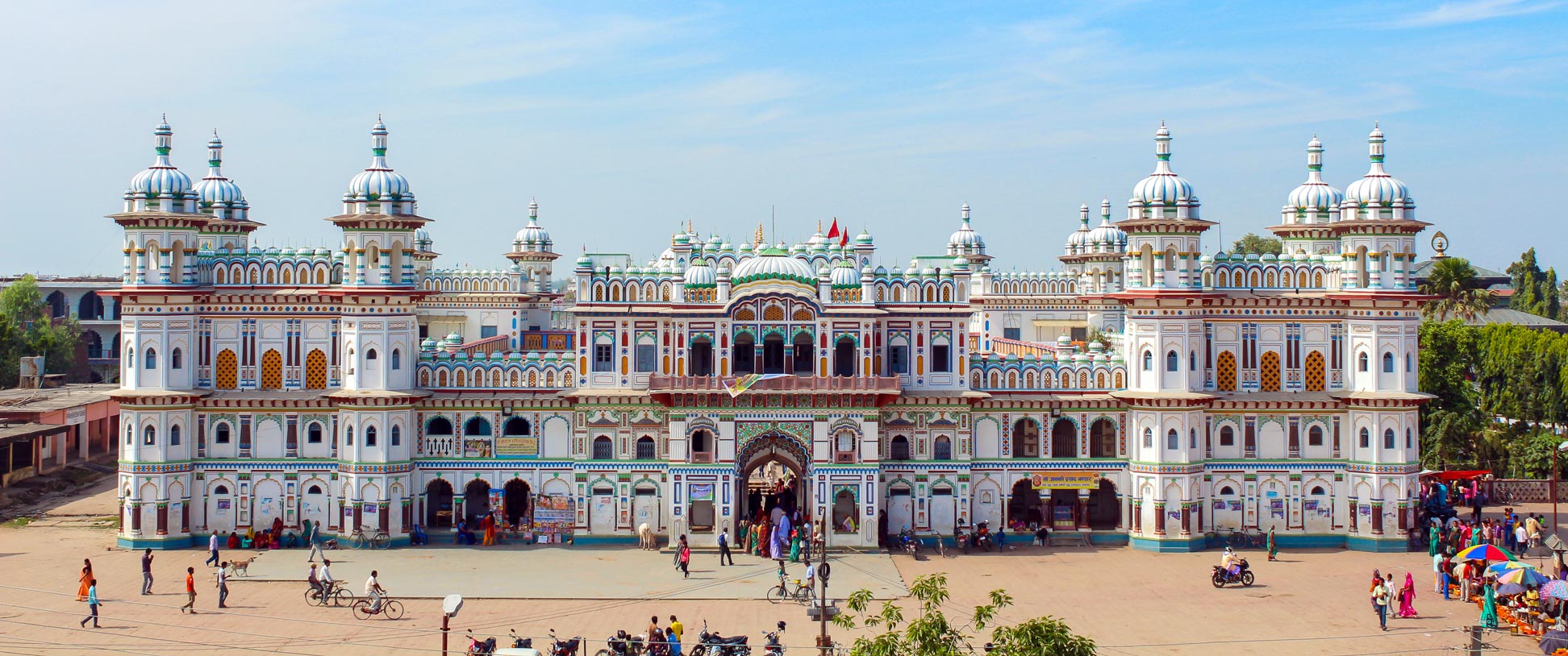
Front of the Janaki Mandir temple in in Janakpur, Nepal
Janaki Mandir temple (Nau Lakha Mandir) in Janakpur, the temporary capital for Province No. 2. The Koiri architecture style temple is dedicated to the Hindu goddess Sita.
Image: Abhishek Dutta

About Nepal


Nepal Flag
The map shows Nepal, a mountainous landlocked country in the Himalayas in southern Asia. It is bordered by China (Tibet Autonomous Region (Xizang)) and by the Indian states of Uttarakhand, Uttar Pradesh, Bihar, West Bengal, and Sikkim.

With an area of 147,181 km², Nepal is somewhat larger than 1.5 times the size of Portugal or slightly larger than the U.S. state of Arkansas.

Nepal has a population of 30.3 million (2021). The largest city and the national capital is Kathmandu.

The language spoken is Nepali; about half of the population speaks the official language Nepali, the rest use one of the more than 120 other Tibeto-Burman languages. The main religions are Hinduism (81%) and Buddhism (9%).


Political Map of Nepal

Political Map of Nepal

The map shows Nepal and surrounding countries with international borders, the national capital Kathmandu, province capitals, major cities, highest mountains, major rivers, main roads, and major airports.

You are free to use the above map for educational and similar purposes. If you publish the map, please credit Nations Online Project as the source.


More about Nepal


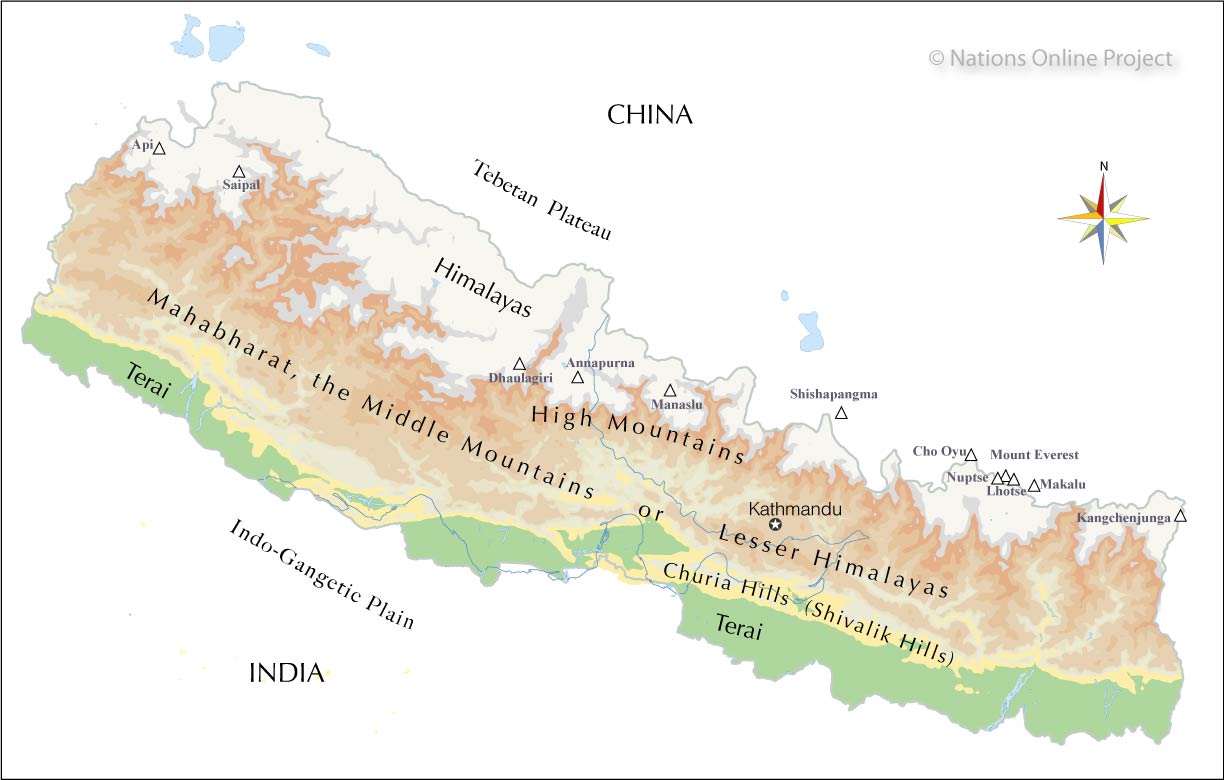
The geographic regions of Nepal - Nations Online Project
Map of Nepal's geographic regions.
Image: nationsonline.org

 
Nepal offers a variety of high-profile geographical features.

Generally speaking, the country consists of five parallel regions running northwest-southeast.

There is the Tarai in the south, the flat northern river plain of the Ganges (Indo-Gangetic Plain) with a belt of marshy grasslands, savannas, and forests. The Tarai has a tropical to subtropical climate.


The terrain changes then northwards to the central hill region, known as the Shivalik (or Churia Hills, the Nepalese section of the Shivalik Hills). The outer foothills of the Himalayas offer elevations between 600 m and 1,200 m.

To the north of the Hill Country are the 'low' mountains of the Lesser Himalayas (called Pahar in Nepali); it includes the Mahabharat mountain range with elevations up to 4,000m. The Kathmandu Valley, the most fertile and urbanized area of the country, is located in the Lesser Himalayas.

North of the Middle Mountains rises the Himalayan range with its eight-thousand-meter peaks, the highlights of Nepal's geography. The majestic, rugged Himalayas of the north. More than half of the world's highest mountains are in the Great Himalayas. Eight of the fourteen eight-thousanders, including Mount Everest, are either entirely in Nepal or sit on a border with Tibet or India (Kangchenjunga).

Nepal's eight-thousanders are Annapurna, Manaslu, Dhaulagiri, Cho Oyu, Makalu, Lhotse, Kangchenjunga, and Everest.
Saipal and Api are two seven-thousanders in the Gurans Himal subrange in northwestern Nepal.


Map shows the location of following Nepalese cities and towns:

Baglung, Baitadi, Beni, Bhaktapur, Bharatpur, Bhojpur, Bidur, Biratnagar, Birendranagar, Birgunj, Bisisahar, Butwal, Chainpur, Chame, Chandragadhi (Bhadrapur), Charikot, Chautara, Dadeldhura, Dailekh, Damauli, Darchula, Dhadingbesi, Dhangadhi, Dhankuta, Dharan, Dhulikhel, Dhunche, Dikte, Dipayal, Duinai, Gaighat, Gamagadhi, Gaur, Ghorahi (largest sub-metropolitan city of Nepal), Godawari, Gorkha, Gulariya, Hetauda, Ilam, Inaruwa, Jajarkot, Jaleswor, Janakpur, Jomosom (Jomsom; Dzongsam), Jumla, Jumlikhalanga, Kalaiya, Kathmandu, Khandbari, Kusma, Liwang, Lumbini, Mahendranagar, Malangawa, Manma, Martadi, Nepalgunj, Okhaldhunga, Parasi, Patan (officially Lalitpur Sub-Metropolitan City, a UNESCO World Heritage Site), Phidim, Pokhara (Nepal's second largest city; pop. 250,000), Pyuthan, Rajbiraj, Ramechhap, Salleri, Salyan, Sandhikharka, Siddharthanagar (Bhairahawa), Silghadi, Simikot, Sindjulimadi, Siraha, Syangja, Tamghas, Tansen, Taplejung, Taulihawa, Terhathum, and Tulsipur.


The map shows the location of some of the world's highest mountains:

Annapurna, 8,091 m (26,545 ft) ranked 10th; Api, 7,132 m; (23,399 ft); Cho Oyu, 8,201 m (26,906 ft)  ranked 6th; Dhaulagiri, 8,167 m (26,795 ft) ranked 7th; Kangchenjunga, 8,586 m (28,169 ft) ranked 3rd; Lhotse, 8,516 m (27,940 ft); ranked 4th), Makalu, 8,463 m (27,766 ft) ranked 5th; Manaslu, 8,156 m (26,759 ft) ranked 8th; Everest, 8,848 m (29,029 ft) ranked 1st; Nuptse, 7,861 m (25,791 ft); Saipal, 7,619 m (24,997 ft), and Shishapangma (officially: Xixiabangma, 8,013 m (26,289 ft) ranked 14th.


Weather Conditions Kathmandu:

KATHMANDU WEATHER


Advertisements:


Maps of other countries in South, Southeast and Eastern Asia
Bangladesh Map, Bhutan Map, Cambodia Map, China Map, India Map, Indonesia Map, Japan Map, Korea (North), Korea (South), Laos Map, Malaysia Map, Maldives Map, Mongolia Map, Myanmar Map, Pakistan Map, Philippines Map, Singapore Map, Sri Lanka Map, Taiwan Map, Thailand Map, Vietnam Map