Advertising

Aztec Calandar - Sun Stone detail. Image by Kim Alaniz
Home Earth Continents The Americas Maps of South America

Maps Index

Maps of South America


Carbajal Valley near Ushuaia in Tierra del Fuego, Argentina, South America
The Carbajal Valley near Ushuaia in Tierra del Fuego is an archipelago and a spur of the Andes, South America's most significant geographical feature.
Image: Andrew Shiva


About South America


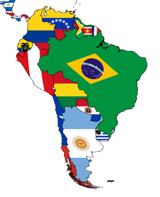
A flag map of South America
South America is a continent that comprises the southern half of the single landmass of the Americas.
It is connected to North America by the Isthmus of Panama.

The continent is located almost entirely in the Southern Hemisphere, bordered in the west by the Humboldt (Peru) Current of the Pacific Ocean, in the east by the Brazil Current of the Atlantic Ocean, and in the north by the Caribbean Sea.

The fourth-largest continent on Earth is home to twelve sovereign states: Argentina, Bolivia, Brazil, Chile, Colombia, Ecuador, Guyana, Paraguay, Peru, Suriname, Uruguay, and Venezuela.


Map of South America

Politcal Map of South America with countries and capital cities
Political Map of South America

The map of South America shows the countries of South America with international borders, national capitals, major cities, rivers, and lakes.

You are free to use the above map for educational and similar purposes; if you publish it online or in print, you need to credit the Nations Online Project as the source.


More about South America


Topographic Map of South America with annotations
Topographic map of South America with annotations on the main geographical features. Clearly visible are the mountain ranges on the western edge of the continent that we know as the Andes Mountains. The map also shows the location of the Guyana Highlands, the Brazilian Highlands, the Espinhaço Mountains, the Amazon Basin and the Amazon River, the Altiplano, Patagonia, Tierra del Fuego, and the Strait of Magellan.
Image: Natural Earth, kk - nationsonline.org


South America is the visible part of the South American continental plate. The continent's lithosphere meets the Caribbean Plate in the Caribbean Sea in the north. In the east, in the middle of the southern Atlantic Ocean, the South American Plate borders the African Plate.

In the west, under the South Pacific Ocean, the Nazca Plate pushes under the South American continent and forms a subduction zone with a trench known as Atacama Trench (Peru–Chile Trench). Its deepest point is at Richards Deep at 8,065 m. The continental movement of the Nazca Plate also created the Andes mountain ranges.


Area
With an area of 17.8 million km², South America is number four on the short list of the largest continents.


Countries (sovereign states) in South America (capital cities in parentheses)

Located on the South American mainland are 12 independent nations and one overseas region of France (French Guiana (Cayenne)).

Argentina (Buenos Aires) | Bolivia (La Paz) | Brazil (Brasilia) | Chile (Santiago) | Colombia (Bogotá D.C.) | Ecuador (Quito) | Guyana (Georgetown) | Paraguay (Asunción) | Peru (Lima) | Suriname (Paramaribo) | Uruguay (Montevideo) | Venezuela (Caracas).

The island state of Trinidad and Tobago (Port-of-Spain), just off the northeastern coast of Venezuela, consisting of two islands, is considered part of the Caribbean.


Population
South America has a population of about 434 million people (2022).


Languages
South America's most commonly spoken languages are Spanish, Portuguese, English, Dutch, French, Aymara, Guaraní, Mapudungun and Quechua.

South America is part of Latin America, a large cultural region in the Americas where Romance languages, Spanish, Portuguese and French, are predominantly spoken.

 
Major geographical features of South America

List of the main physical regions of the South American continent.
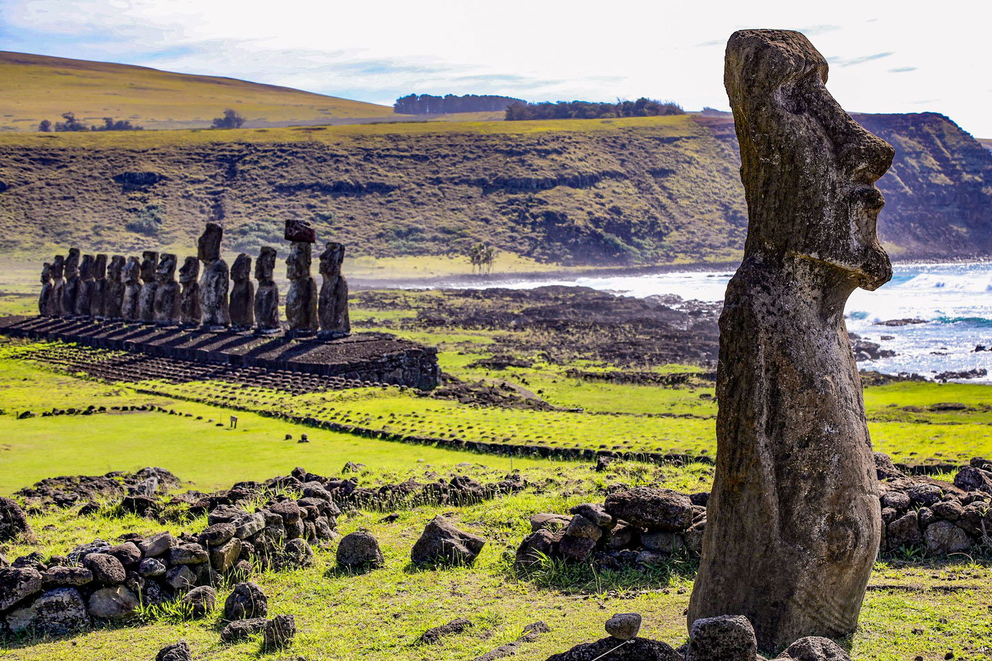


Moai figures on Easter Island (Rapa Nui), Polynesia.
The Moai figures on the Easter Island (Rapa Nui) are monolithic human figures made by the Rapa Nui people between the mid-13th and 16th centuries.
Image: Wendi Halet

Islands
The continent includes the Falkland Islands, an archipelago of more than 100 islands in the South Atlantic Ocean, an overseas territory of the UK since January 1833, claimed by Argentina.


Easter Island (Isla de Pascua; Rapa Nui) is the easternmost island of Polynesia in the southeastern Pacific Ocean. The Chilean dependency lies more than 3,700 km (2,300 mi) west of the coast of Chile.
The island is famous for its nearly 900 monumental statues, the Moai, created by the islanders between the 13th and 16th centuries.


The Galápagos Islands are an archipelago in the Pacific Ocean on the equator, about 1,000 km (620 miles) west of Ecuador's coast. The Galapagos Islands are known for their large number of endemic species, which Charles Darwin studied in the 19th century. He published the results of his studies in his famous book "The Origin of Species." Today, the Galápagos Islands are a World Heritage Site.


Tierra del Fuego
The archipelago of Tierra del Fuego forms the southern tip of the South American continent. Isla Grande de Tierra del Fuego, the largest island in South America, is separated from the mainland by the Strait of Magellan.
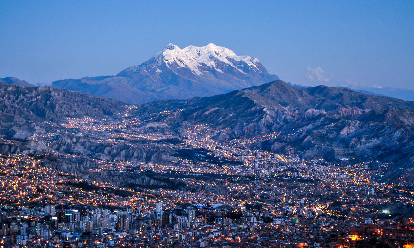


View of La Paz, Bolivia's capital city, with Illimani Mountain in the background.
View of La Paz. Bolivia's third largest city and the seat of the country's government is located on the Altiplano. La Paz is the highest capital city in the world at 3,640 m. In the background, the 6,438 m (21,122 ft) high snow-covered Illimani Mountain, the highest mountain in the Cordillera Real, a subrange of the Andes.
Image: EEJCC

Mountains
The highest point in South America is Mount Aconcagua (6,962 m; 22,840 ft), located in the Andes Mountain Range in Argentina.

The Andes are a continental mountain range in western South America, the longest mountain range in the world. The various Cordilleras of the Andes stretch for more than 8,600 km along the continent's west coast, crossing seven countries.

The Andes were formed by plate tectonics, the collision of two crustal plates. The denser oceanic Nazca plate had pushed under the lighter continental South American plate and formed a subduction zone. In the process, the Nazca plate is pushed downward, creating a trench, and the continental crust of South America is pushed upward, creating the Andes mountain range.
The subduction zone is an area of intense volcanic activity; it forms the eastern section of the Pacific Ring of Fire. The subduction zone of South America is one of the world's most earthquake-prone regions. [USGS]


Altiplano
The Altiplano (High Plateau) is a high-altitude tableland in the Andes mountain range shared mainly between Peru and Bolivia, with some areas in Chile. The plateau lies at an average altitude of about 3,750 m (12,300 feet), grasses and shrubs dominate the landscape. The Altiplano is the site of Lake Titicaca and the Salar de Uyuni (see below). The Altiplano is also Bolivia's most densely populated region. La Paz, Bolivia's second-largest city and administrative capital, is located on the Altiplano.
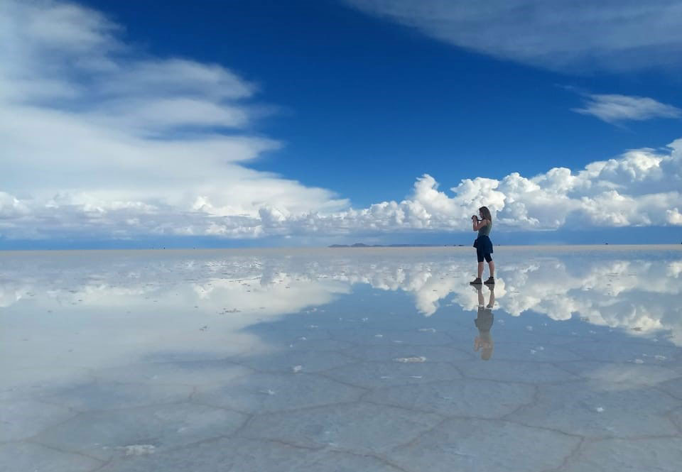

Reflection of the sky in the water of Salar de Uyuni, Bolivia
Reflection of the sky in the Salar de Uyuni. The world's largest salt flat is located in the southwest of Bolivia at an elevation of 3,656 m (11,995 ft). [NG]
Image: Jeferson Herbert

Gran Chaco
The Gran Chaco (Quechua: Hunting Land) in the interior of the South American continent is a rather sparsely populated subtropical semiarid alluvial lowland in western Paraguay and northern Argentina.


Llanos
The Llanos (Spanish: "Plains") are a vast tropical grassy plain east of the Andes Mountains in Colombia and Venezuela in northwestern South America.


Pampas
The Pampas (Quechua: flat surface area) is a vast area of nearly treeless and fertile grasslands in southeastern South America.


Pantanal
The Pantanal is an extensive tropical seasonal wetland and savanna ecoregion at the headwaters of the Paraguay River in southwestern Brazil; it is the world's largest tropical wetland area.


Patagonia
Patagonia is a plateau in the southern part of South America; it covers a vast area from the Colorado River in central Argentina to the Strait of Magellan and from the eastern foothills of the Andes to the Atlantic coast.


Rivers
Major rivers are the Amazon River (Amazonas) with its tributaries Rio Madeira, Rio Negro, and Rio Xingu, Rio Magdalena, Rio Orinoco. The Amazon River is the largest river by discharge of water in the world.

The Tocantins River, São Francisco River, and Rio Paraná are not tributaries of the Amazon.
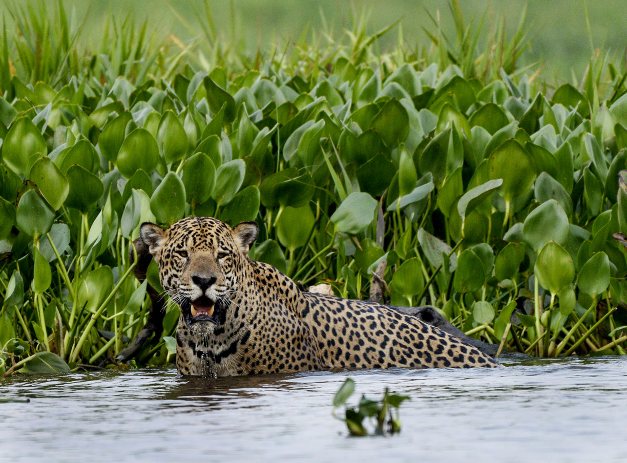


A jaguar in the northern Pantanal.
A jaguar in the northern Pantanal, the largest tropical wetland in the world, located mainly in the Brazilian state of Mato Grosso do Sul. Jaguars used to be found from the southwestern United States across South America to almost the far north of Argentina. Now they are virtually extinct in half of their historic range. [WWF]
Image: Jan Fleschmann

Lakes
Lake Maracaibo in western Venezuela is an inlet of the Caribbean Sea and the largest lake in South America.
Lake Titicaca in the Andes, on the border of Peru and Bolivia, is the continent's largest lake; it is also the highest navigable lake in the world at an altitude of 3,812 m (12,507 ft).


South America Geographic Extremes

Geographical highlights of South America: highest point, deepest point, longest mountain range, etc.

The highest point in South America is Aconcagua at 6,960.8 meters; it is the highest mountain in the Americas and the highest peak outside of Asia.

The lowest point of South America, at -105 m, is Laguna del Carbón, a salt lake in Santa Cruz province of Argentina.

The Amazon River is the largest river by water discharge and the second-longest river system in the world after the Nile.

Lake Titicaca, on the border of Peru and Bolivia, is the continent's largest lake; it is also the highest navigable lake in the world at 3,812 m (12,507 ft).


The extreme points of the South American mainland.

The northernmost point is at Punta Gallinas, a cape at the tip of the Guajira Peninsula in northern Colombia.

The southernmost point of the mainland is at Cape Froward on the southern tip of the Brunswick Peninsula at the northern shores of the Magellan Strait in Chile. The southernmost point of the continent is at treacherous Cape Horn.

The westernmost point is at Punta Pariña, a cape in Piura Region in northwestern Peru.

The easternmost point is at Ponta do Seixas, also known as Cape Branco in Brazil's Paraíba state near its provincial capital João Pessoa.


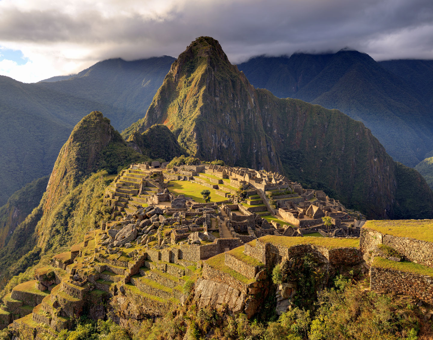
Historic Inca Sanctuary of Machu Picchu in Peru
There are over 70 World Heritage Sites in South America.
One of the most famous of these sites is the Historic Sanctuary of Machu Picchu, the ruins of a city of the Inca civilization near Cuzco, Peru.

Image: Martin St-Amant (S23678)
 
Famous World Heritage Sites in South America

There are over 70 World Heritage Sites in South America. [WP]


Brasília
Among the most famous World Heritage Sites in South America is certainly Brasilia UNESCO website, the planned city and capital of Brazil.
Brasília, the new capital, was built in the center of Brazil according to the plans of urban planner Lucio Costa and architect Oscar Niemeyer. The futuristic city was inaugurated on 21 April 1960.


Cuzco
The City of Cuzco UNESCO website in the Peruvian Andes developed under the Inca king Pachacutec to become the core of the Inca Empire in the 15th century.


Galápagos Islands
The Galápagos Islands UNESCO website, a province of Ecuador, is an archipelago of volcanic islands in the Pacific Ocean. Galápagos is known as a unique 'living museum and showcase of evolution.' The islands became famous through Charles Darwin. His theory of evolution is based mainly on observations he made during his five-week stay on the archipelago.


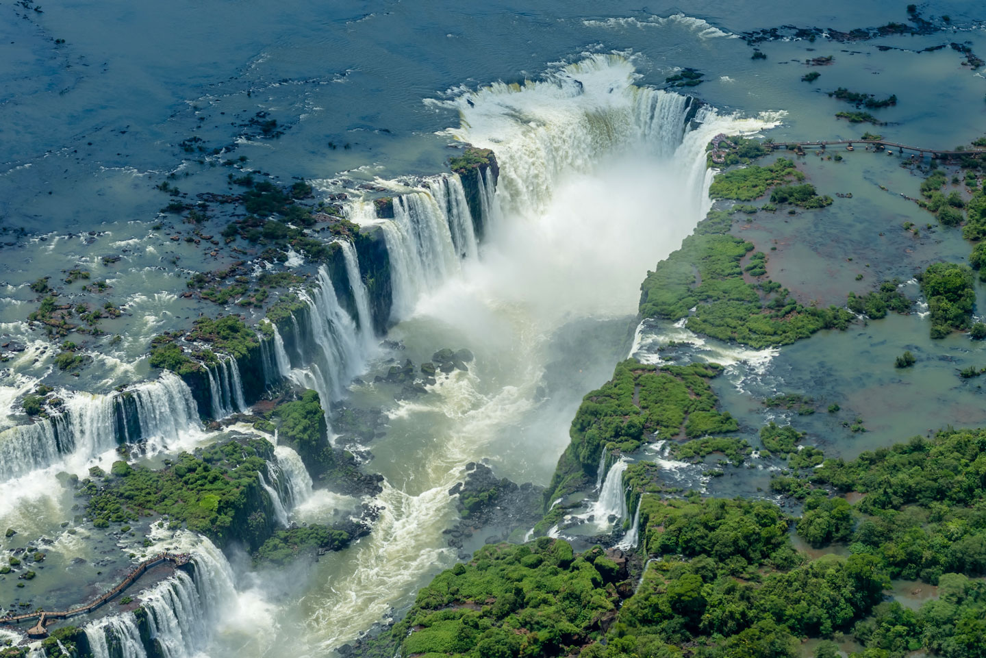
Iguazu Falls is located on the border between the Argentine province of Misiones and the Brazilian state of Paraná.
Iguazu Falls, one of the most spectacular waterfalls in the world, is situated within two national parks, the Iguaçu and the Iguazu National Parks - one in Brazil, the other in Argentina.[WP]
Image: Enaldo Valadares
 
Iguaçu National Park
The Iguaçu National Park UNESCO website is located in the Brazilian State of Paraná and the Misiones Province of Argentina. The park with subtropical rainforest surrounds the Iguazu Falls, one of the largest and most spectacular waterfalls in the world.


Machu Picchu
The Historic Sanctuary of Machu Picchu UNESCO website was built during the middle of the 15th century and abandoned approximately 100 years later. Located 2,430 meters above sea level in the Peruvian Andes, the urban complex is considered the most important legacy of the Inca civilization, but its exact former use remains a mystery.


Nazca
Lines and Geoglyphs of Nasca and Palpa UNESCO website are a group of gigantic geoglyphs made in the soil of the Nazca Desert in southern Peru. The lines were scratched on the ground's surface between 500 BCE and 500 CE. The Nazca Lines are among archaeological mysteries because of their number, nature, size, and continuity.


Quito
The City of Quito UNESCO website was founded in the 16th century on the ruins of an Inca city; it is the best-preserved, least-altered historic urban center in Latin America.


Rio de Janeiro
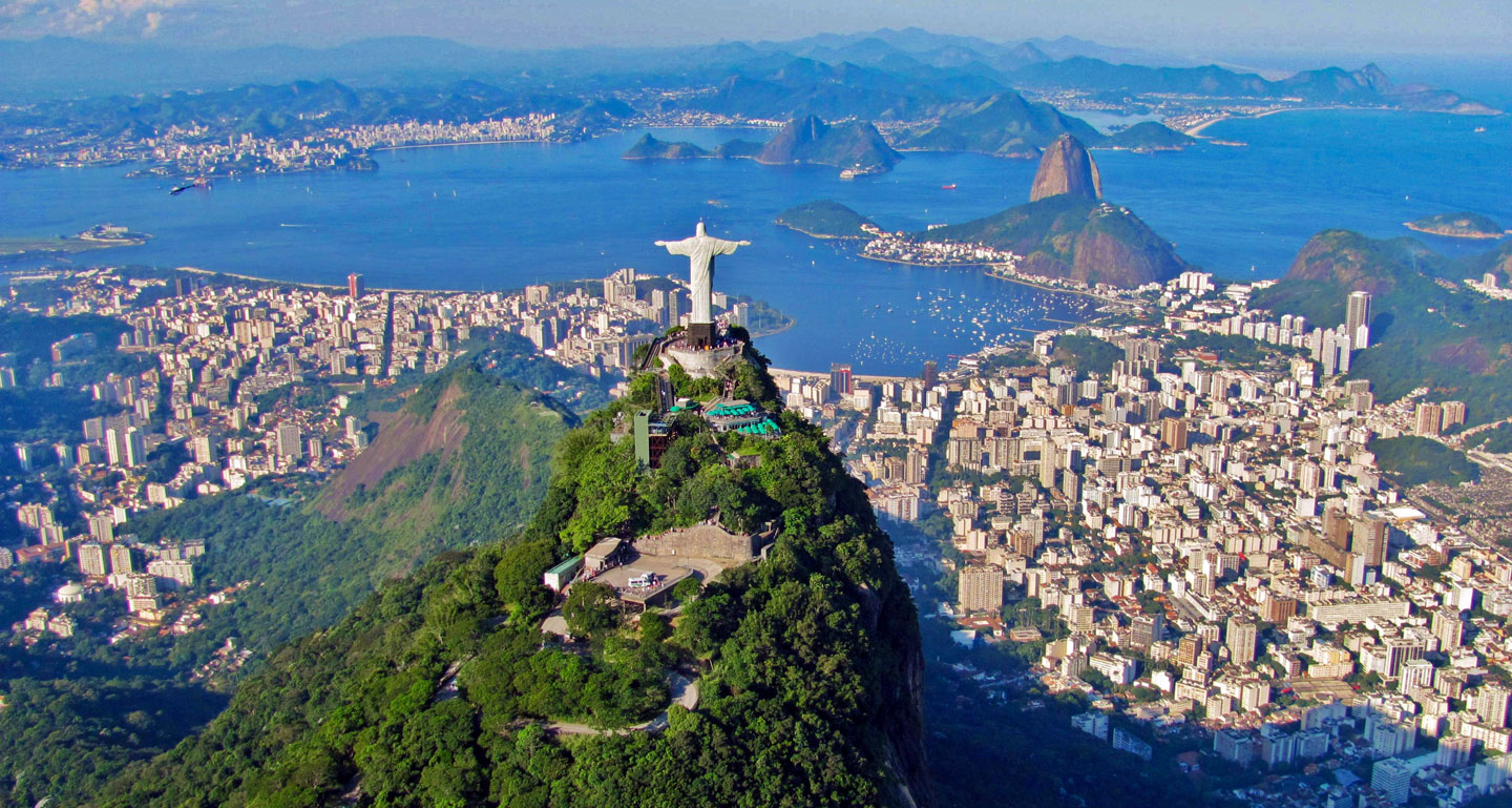
The World Heritage Site Carioca Landscapes between the Mountain and the Sea UNESCO website includes the natural and structural elements that have shaped Rio de Janeiro's urban landscape, such as the Tijuca Massif, the Sugarloaf Mountain, Corcovado Hill with the famous statue of Christ the Redeemer, the Botanical Gardens founded in 1808, and the designed landscapes along Copacabana Bay.


The map shows the location of the following major cities in South America.


Aerial view of Rio de Janeiro with Christ the Redeemer statue on Mount Corcovado and Sugarloaf Mountain in the background
Aerial view of Rio de Janeiro, with 38m tall Christ the Redeemer statue atop Mount Corcovado (center) and the Sugarloaf Mountain in the background.
Image: Rafael Rabello de Barros
 
Major Argentine Cities:
Capital city: Buenos Aires
Bahía Blanca, Comodoro Rivadavia, Córdoba, Río Gallegos, La Plata, Mar del Plata, Mendoza, Resistencia, Rosario, Salta, San Carlos de Bariloche, San Miguel de Tucumán, Santa Fe and Ushuaia.

Major Bolivian Cities
Capital city: La Paz
Cochabamba, Potosí, Santa Cruz, Sucre and Trinidad

Major Brazilian Cities:
Capital city: Brasília
Aracaju, Belém, Belo Horizonte, Boa Vista, Campo Grande, Cuiabá, Curitiba, Florianópolis, Fortaleza, Goiânia, João Pessoa, Macapá, Maceió, Manaus, Natal, Palmas, Pôrto Alegre, Pôrto Velho, Recife, Rio Branco, Rio de Janeiro, Salvador, Santarém, Santos, São Luís, São Paulo, Teresina, Uberlândia and Vitória.

Major Chilean Cities
Capital city: Santiago
Antofagasta, Arica, Concepción, Iquique, Puerto Montt, Punta Arenas and Valparaíso.

Major Colombian Cities
Capital city: Bogotá
Barranquilla, Cali, Cartagena, Cúcuta, Medellín


Advertisements:


Major Ecuadorian Cities
Capital city: Quito
Cuenca and Guayaquil.

Major Peruvian Cities
Capital city: Lima
Arequipa, Cusco, Huánuco, Iquitos, Piura and Trujillo.

Major Venezuelan Cities
Capital city: Caracas
Barquisimeto, Ciudad Guayana, Maracaibo, San Cristóbal and Valencia.

Other cities:
Georgetown, the capital city of Guyana; Paramaribo, the capital of Suriname; Cayenne, the capital city of French Guiana (France); Montevideo, the capital of Uruguay.
 

Advertisements:


Maps of Countries in South America:
Argentina Map, Brazil Map, Bolivia Map, Chile Map, Colombia Map, Ecuador Map, French Guiana, Guyana Map,
Paraguay Map, Peru Map, Suriname Map, Uruguay Map, Venezuela Map

Maps of Countries in Central America:
Belize Map, Costa Rica Map, El Salvador Map, Guatemala Map, Honduras Map, Nicaragua Map, Panama Map