Maps Index
| Maps Index |
|
|
|
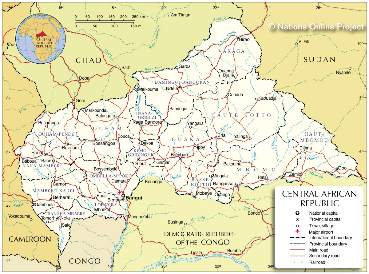
___ Administrative Map of Central African Republic |
|
Map is showing Central African Republic and the surrounding countries with international borders, provinces boundaries, the national capital Bangui, provinces capitals, major cities, main roads, railroads and airports. Border Countries: Cameroon, Chad, Democratic Republic of the Congo, Republic of the Congo, Sudan Administrative Divisions of the Central African RepublicThe Central African Republic is divided into 14 administrative prefectures (préfectures), 2 economic prefectures (préfectures economiques) and one autonomous commune.The prefectures are (prefecture capital in brackets): Bamingui-Bangoran (Ndélé), Basse-Kotto (Mobaye), Haute-Kotto (Bria), Haut-Mbomou (Obo), Kémo (Sibut), Lobaye (Mbaïki), Mambéré-Kadéï (), Mbomou (), Nana-Mambéré (Bouar), Ombella-M'Poko (Bimbo), Ouaka (Bambari), Ouham (Bossangoa), Ouham-Pendé (Bozoum), Vakaga (Birao) the two economic prefectures are Nana-Grébizi (Kaga Bandoro) and Sangha-Mbaéré (Nola); the autonomous commune is Bangui. |
 Bookmark/share this page |
 One World - Nations Online All Countries of the World |
|
|
||
One World - Nations Online .:. let's care for this planet Every nation is responsible for the current state of our world. |
| Site Map
| Information Sources | Disclaimer: Privacy Policy, etc. Contact: [email protected] | Copyright © 1998-2021 :: nationsonline.org |