
One World
Nations Online
Countries in the World
 |
|
 One World Nations Online Countries in the World | |
Home  |
___ Satellite View and Map of the City of Prague (Czech: Praha), Czech Republic
|
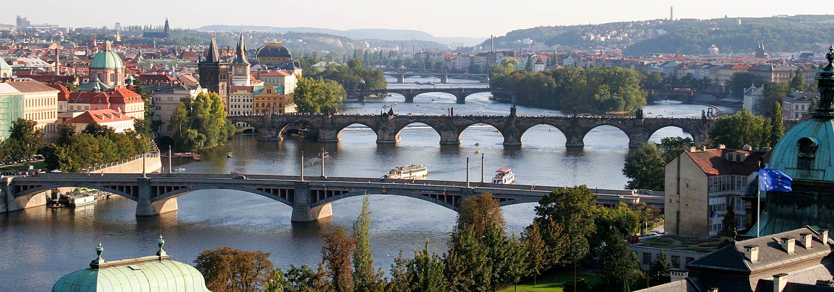
 Bridges over Vltava River in Central Prague, the second bridge (front to back) is the famous historic Charles Bridge. Image by che |
About Prague Map is showing Prague, largest city and the national capital of the Map is showing Prague, largest city and the national capital of the The historical capital of Bohemia and former capital of Czechoslovakia has been for centuries a city with political and cultural influence, and a major trading hub in Central Europe. In the 14th-century Prague was the third-largest city in Europe (after Rome and Constantinople). The historic centre of Prague is today a UNESCO World Heritage Site In the center of the city is the Old Town Square with the Prague astronomical clock, which was installed in 1410. Other magnificent monuments, such as St Vitus Cathedral, and numerous churches and palaces are built mostly in the 14th century under the Holy Roman Emperor, Charles IV. Also worth a visit is the historical fort Vyšehrad, the famous historic Charles Bridge, the Jewish Quarter, and the recreational area of Petřín hill. The cultural and economical center of the Czech nation has a city population of about 1.2 million inhabitants, 2 million people live in its metropolitan area. Just zoom in (in satellite view) and you will see Charles Bridge (Czech: Karlův most), the famous historical bridge that crosses the Vltava river. The map shows a city map of Prague with expressways, main roads and streets, zoom out to find the location of Václav Havel Airport Prague (formerly Ruzyně International Airport; IATA code: PRG) about 16.3 km (10 mi) by road, west of the city center. To find a location use the form below. To view just the map, click on the "Map" button. |
|
| To find a location type: street or place, city, optional: state, country. |
Local Time Prague:
Wednsday-April-24 01:50
Standard Time Zone (CET): UTC/GMT +1 hourCEST (Daylight Saving Time) in use from end of March until end of October: time zone offset: UTC/GMT +2 hours |
|
φ Latitude, λ Longitude (of Map center; move the map to see coordinates): , |
||||||
| Google Earth: Satellite View and Map of Prague, Czech Republic. City Coordinates: 50°05′N 14°25′E |
Bookmark/share this page
|
|||||
| More about the Czech Republic: Country: Continent: External Links: Prague (official website) Wikipedia: Prague |
Weather Conditions Prague |
Related Consumer Information:
|
||||
| Other Cities in Eastern Europe: Bratislava | Bucharest | Budapest | Chisinau | Kiev | Minsk | Moscow | Prague | Sofia | Warsaw Europe Alpha City Tour: Rome - Zürich - Madrid - Paris - Amsterdam - London - Stockholm - Berlin - Prague - Vienna - Istanbul Countries and Territories of Europe |
||||||
Map Help [ show ]  |
||||||
One World - Nations Online .:. let's care for this planet Promote that every nation assumes responsibility for our world. Nations Online Project is made to improve cross-cultural understanding and global awareness. More signal - less NOISE |
| Site Map
| Information Sources | Disclaimer | Copyright © 1998-2023 :: nationsonline.org |