Nations Online
All Countries in the World
|
One Planet Nations Online All Countries in the World | |
Home  |
___ Satellite View and Map of Republic of Macedonia (FYROM) |
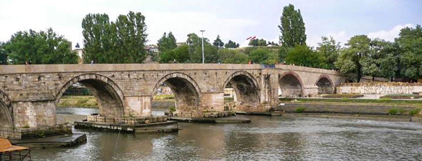
 The Stone Bridge over Vardar river (Axios river) in Skopje, Republic of Macedonia. The Stone Bridge over Vardar river (Axios river) in Skopje, Republic of Macedonia. |
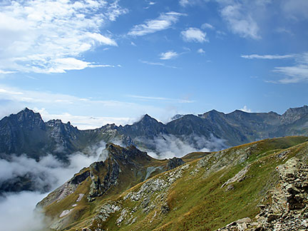
About Macedonia Map view is showing the mountainous landlocked country on the Balkan Peninsula in southeastern Europe. It is bordered by Albania, Bulgaria, Greece, Serbia and Kosovo. The country was formerly a Republic within Yugoslavia, it gained independence in 1991. Due to an ongoing dispute with Greece about the use of the name of Macedonia (the bordering northern region of Greece is also known as Macedonia), the country is now known as the 'Former Yugoslav Republic of Macedonia' or short FYROM or Republic of Macedonia. The small nation covers only a part of the larger historical and geographical area known as Macedonia. Its culture and lifestyle has Ottoman and European influences. Map view is showing the mountainous landlocked country on the Balkan Peninsula in southeastern Europe. It is bordered by Albania, Bulgaria, Greece, Serbia and Kosovo. The country was formerly a Republic within Yugoslavia, it gained independence in 1991. Due to an ongoing dispute with Greece about the use of the name of Macedonia (the bordering northern region of Greece is also known as Macedonia), the country is now known as the 'Former Yugoslav Republic of Macedonia' or short FYROM or Republic of Macedonia. The small nation covers only a part of the larger historical and geographical area known as Macedonia. Its culture and lifestyle has Ottoman and European influences. Landscape of Mount Korab, the highest mountain in both countries, the Republic of Macedonia and Albania, seen from the Macedonian side. Image: Don macedone The Republic of Macedonia has a population of just over 2 million people (2014), largest city and the national capital is The satellite view shows the mountainous landscape of the Republic of Macedonia with its deep basins and valleys, cities, towns, expressways, main roads and streets. To find a location use the form below. To view just the map, click on the "Map" button. |
|
| To find a location type: street or place, city, optional: state, country. |
Local Time Macedonia:
Friday-April-26 11:12
Standard Time Zone (CET): UTC/GMT +1 hourCEST (Daylight Saving Time) in use from end of March until end of October. Time zone offset: UTC/GMT +2 hours |
One World - Nations Online .:. let's care for this planet Promote that every nation assumes responsibility for our world. Nations Online Project is made to improve cross-cultural understanding and global awareness. More signal - less NOISE |
| Site Map
| Information Sources | Disclaimer | Copyright © 1998-2023 :: nationsonline.org |